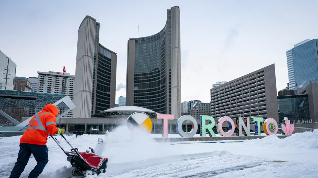
Winter will make an appearance in parts of Canada this weekend, as temperatures plummet with a side of potential snowfall.
Here’s what different parts of the country can expect from the weather this weekend, according to Environment Canada meteorologists.
Newfoundland and Labrador
Saturday looks nice across Newfoundland and Labrador, Mike Vandenberg, a meteorologist in Gander, Newfoundland said, with a mix of sun and cloud.
However, a “fairly benign” low pressure system could cross the island portion of the province Saturday night into Sunday and bring a “shot of rain” of between 20 to 40 mm for most of Newfoundland.
Up in Labrador, variable cloudiness is forecast, with scattered flurries or showers throughout the weekend.
As for the snow, Vanderberg said it’s a possibility that some higher terrain areas there could see the white stuff, including potentially a centimetre or two in Labrador.
“But by and large, Newfoundland is looking like a bit of a rainy centre of the weekend,” he said.
PEI, New Brunswick and Nova Scotia
Andy Firth from the Dartmouth, Nova Scotia Environment Canada office, said there’s a low-pressure system moving into the region on Friday, with rain expected to develop overnight or Saturday morning across the Maritimes.
Some light snow is expected overnight in New Brunswick.
That rain will persist for Nova Scotia into Saturday evening, though things are expected to clear up in New Brunswick and PEI later in the day.
By Sunday, Firth said things will be looking “ho hum” with a mix of sun and cloud and seasonal temperatures.
Ontario
Sunday would be the “show stopper,” with a special weather statement in effect for portions of southern Ontario, said Trudy Kidd, operational meteorologist for Ontario.
Snow is forecast to begin Saturday morning, and some areas will see a mix of rain and snow.
“It might exceed 10 cm,” she said.
The area between London and Pembroke, including Kingston, the Greater Toronto Area and Lake Simcoe are expected to have a range of between two and 10 cm of snowfall throughout the day on Sunday.
Eastern Ontario might see five to 15 cm on Sunday in areas like Ottawa, Cornwall, Prescott and Russell.
However, Kidd noted that there’s still a lot of uncertainty with the weather system coming.
“When the temperatures are around zero, it’s extra tricky to figure out what the precipitation type is going to be,” said Kidd. “The system coming could move farther to the South.”
If the system moves farther to the north, there will be more warm air and less snow. It’s still unclear how strong the storm system will be, she said.
Kidd stressed that residents of southern Ontario should stay aware of the weather this weekend.
Quebec
Snow is expected by the end of Sunday in the most southern part of the province, Simon Legault said from Montreal. There will mostly be rain in the townships of Quebec, though the townships in higher terrain could see some snow, he said.
Places like the Laurentians, Quebec City and Saguenay should see the highest accumulation of snow.
In Montreal, there could be 5 to 10 cm of snow overnight Sunday and into the morning on Monday, which could impact the morning commute.
He admits that snowfall looks to be coming earlier than it had in past years and advised people to get prepared.
Manitoba, Saskatchewan and Alberta
James Colangelo, a meteorologist for the Prairies, said the biggest system that’s moving through the west is making its way through southern Alberta and southern Saskatchewan, which will bring snow on Friday into Saturday morning through southern Saskatchewan.
Bitterly cold temperatures are expected for Saturday and Sunday, particularly in Saskatchewan, where the mercury can dip to as low as -20 degrees.
On Friday night into Saturday morning, northeastern Manitoba in the Churchill region can expect things to get blustery.
“Areas along the Hudson Bay coast could see some blizzard conditions with that low-pressure system, as it brings snow and blowing snow to the area,” he said.
For the western region, he said it looks like “a fairly quiet weekend – precipitation-wise”. But then it looks like warmer temperatures return as a warm air push comes in from the West.
British Columbia and Yukon
Brian Proctor, meteorologist for British Columbia and the Yukon, said in the wake of a pretty stormy week over much of B.C., the weather conditions are decent for the weekend across the southern part of the province.
The Greater Vancouver area, inner south coast and across the interior will see generally sunny skies on Saturday, with seasonal temperatures. A bit more wet weather is expected up on the north coast and across the northern interior.
“We got a funnel system that will be moving on shore onto the north coast on Saturday and thickening the cloud up across norther B.C. Saturday into Sunday,” he said. “So expect heavy rains and significant winds up on the north coast.”
Periods of snow are set to develop through the weekend for much of the northern interior, with the possibility of freezing rain as well.
There will be deteriorating conditions from Saturday onwards for northern B.C. and generally fair weather across southern B.C.
Nunavut and Northwest Territories
There’s not much out of the ordinary in the forecast for the region territories. Some light snow is expected in northern Northwest Territories but no reports of big accumulations.
The real system of note comes into the NWT starting Sunday night when a low-pressure system moves in from the southwest.
“That should bring a relatively heavy band of snow,” Wagar said. “Anywhere north of Great Slave Lake should see snow, and the south should see rain and there’s a risk of freezing rain in between.”
For temperatures, things are relatively cool in the central arctic, with highs around -10, which is warmer than normal for this time of year. However, things will be warmer in NWT and eastern Nunavut.
Source: CTV News
